
STOCK TITAN

Inertial Labs, a VIAVI Solutions Company, Advances 3D Terrain and Surface Modeling with PCMasterPro 1.16 for RESEPI

(Very Positive)
Tags

Inertial Labs, a VIAVI Solutions company (NASDAQ: VIAV) released PCMasterPro 1.16 on April 16, 2026, a 3D terrain and feature modeling software update with enterprise-scale processing and up to 200% faster performance. The release adds automated batch processing, command-line utilities, real-time haptics, expanded export formats (PCD, PLY, E57, LAS, LAZ), enhanced coordinate-system support, accuracy reporting, colorization, real-time streaming, ground-control-point support and an improved camera calibration toolchain for RESEPI workflows.

PCMasterPro 1.16 targets engineers, cartographers, surveyors and VFX designers to create realistic digital twins from RESEPI sensor data with scalable parallel processing and improved user workflows.

Loading...
Loading translation...

Positive

  • Processing performance improved by up to 200%
  • Enterprise-scale batch processing with profiles and templates
  • Expanded export formats: PCD, PLY, E57, LAS, LAZ
  • Supports real-time streaming and haptics for quality control
  • Improved calibration toolchain for camera alignment and projection

Negative

  • None.

News Market Reaction – VIAV

+4.84%
35 alerts
+4.84% News Effect
+8.2% Peak in 29 hr 51 min
+$473M Valuation Impact
$10.25B Market Cap
0.7x Rel. Volume

On the day this news was published, VIAV gained 4.84%, reflecting a moderate positive market reaction. Argus tracked a peak move of +8.2% during that session. Our momentum scanner triggered 35 alerts that day, indicating elevated trading interest and price volatility. This price movement added approximately $473M to the company's valuation, bringing the market cap to $10.25B at that time.

Data tracked by StockTitan Argus on the day of publication.

Market Context

This announcement highlights VIAVI’s continued build-out of its 3D and geospatial capabilities, with...
Analysis

This announcement highlights VIAVI’s continued build-out of its 3D and geospatial capabilities, with PCMasterPro 1.16 delivering up to 200% faster processing and expanded support for the RESEPI platform. The update adds automation, real-time haptics, broader export formats and improved camera calibration, enhancing digital twin workflows. In context of recent product launches and partnerships, investors may watch how quickly these tools penetrate customer workflows and how frequently the company leverages its effective S-3ASR shelf from 2025-08-11.

Key Figures

Processing speed gain: Up to 200% faster
1 metrics
Processing speed gain Up to 200% faster PCMasterPro 1.16 3D processing performance

Historical Context

5 past events · Latest: Apr 14 (Positive)
Pattern 5 events
Date Event Sentiment 24h Move Catalyst
Apr 14 Optical link milestone Positive -1.7% Commercial deployment of 400 Gbps full‑duplex wireless optical links.
Apr 14 Certification tool news Positive -1.7% TTworkbench and M1 Appliance recognized as Avnu certification test tools.
Apr 02 Maritime partnership Positive +4.5% Partnership with Ground Control for assured maritime tracking in GNSS-denied areas.
Mar 18 Security product launch Positive +5.2% Launch of Observer Threat Forensics NetSecOps solution with retrospective analysis.
Mar 17 Conference collaboration Positive -2.4% High-speed connectivity demos with Infraeo at OFC 2026 using VIAVI platforms.

24h Move is the share-price change in the day after each event; other market factors may also have contributed.

Pattern Detected

Recent product and partnership announcements often saw mixed reactions, with several positive news items followed by negative price moves and a couple of strong upside responses.

Recent Company History

Over the last month, VIAVI reported multiple technology-focused updates. On Mar 17, a joint OFC 2026 showcase with Infraeo was followed by a -2.41% move. The launch of Observer Threat Forensics on Mar 18 coincided with a 5.19% gain. A maritime GNSS-denied navigation partnership on Apr 2 saw shares up 4.5%. However, two news items on Apr 14 related to 400 Gbps optical links and Avnu certification both aligned with a -1.69% decline. Today’s RESEPI-focused software upgrade fits this pattern of frequent product innovations met with variable market responses.

Key Terms

digital twin, gnss-aided inertial navigation system, lidar, simultaneous localization and mapping (slam), +2 more
6 terms
digital twin technical
"create realistic digital twin models based on geospatial and 3D data"
A digital twin is a live virtual replica of a physical asset, process, or system that mirrors real-world behavior using data and models so users can test changes, predict problems, and measure performance without touching the real thing. For investors, digital twins matter because they can lower maintenance costs, speed product development, improve uptime and reliability, and make future cash flows and risks easier to forecast — like using a flight simulator to safely train and tune a real airplane.
gnss-aided inertial navigation system technical
"combined Dual Antenna GNSS-Aided Inertial Navigation System, datalogger, LiDAR"
A GNSS-aided inertial navigation system combines satellite positioning (like GPS) with internal motion sensors that measure acceleration and rotation to track an object’s position and movement. Think of it as a phone’s map that uses both satellite fixes and an internal pedometer/compass so it keeps working and stays accurate when satellites are blocked or signals jump around. Investors care because it improves product reliability, safety, and marketability for vehicles, drones, and other automated systems, which can affect sales, regulation risk, and competitive advantage.
lidar technical
"GNSS-Aided Inertial Navigation System, datalogger, LiDAR, camera and communications system"
Lidar, which stands for Light Detection and Ranging, is a technology that uses laser beams to create detailed, three-dimensional maps of the environment. It works like a sophisticated eye that measures distances by bouncing light off objects, helping machines see and understand their surroundings. For investors, lidar is important because it enables advancements in autonomous vehicles, robotics, and mapping, which can drive innovation and growth in related industries.
simultaneous localization and mapping (slam) technical
"locally referenced simultaneous localization and mapping (SLAM) generated point clouds"
Simultaneous localization and mapping (SLAM) is a technology that lets a moving device create a map of an unfamiliar environment while continuously determining its own location within that map using sensors such as cameras, lidar, or sonar. For investors, SLAM matters because it is a core capability behind autonomous robots, self-driving vehicles, drones, and augmented-reality systems—like a traveler drawing a map as they walk so they won’t get lost—so companies that develop reliable SLAM can enable new products, reduce operating costs, and open recurring-revenue opportunities.
point cloud technical
"allows for the real-time and post-processed generation of point cloud solutions"
A point cloud is a digital collection of many individual dots in three-dimensional space that together represent the shape and surface of a physical object, area, or scene, typically captured by sensors such as LIDAR or 3D cameras. Investors care because point clouds are the raw material for mapping, inspection, simulation and autonomous navigation; their quality and volume determine how well a company can build products, cut manual work, reduce risk, and monetize location or asset data.
ground control points technical
"enhanced support for ground control points and more"
Physical markers or precisely measured reference points on the ground used to align and calibrate aerial, drone, or satellite images with real-world coordinates — like tacking landmarks onto a photo so it lines up with a map. For investors, they matter because accurate imagery underpins property boundaries, progress tracking, environmental checks and asset verification; unreliable control points can lead to mistaken valuations or missed risks.

AI-generated analysis. How Rhea-AI works. Not financial advice.

See more from StockTitan in Google Search and AI answers. Adds StockTitan as a preferred source · opens Google
Add on Google

New software with enterprise-scale 3D processing delivers up to 200% faster performance
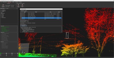
CHANDLER, Ariz., April 16, 2026 /PRNewswire/ -- Inertial Labs, a VIAVI Solutions Inc. (VIAVI) (NASDAQ: VIAV) Company, today announced its new PCMasterPro 1.16 software for 3D terrain and feature modeling, which now includes scalable enterprise capabilities and up to 200% faster processing speed. Combined with other new features including automated capabilities and real-time haptics, PCMasterPro 1.16 helps engineers, cartographers, surveyors and VFX designers to create realistic digital twin models based on geospatial and 3D data.

PCMasterPro 1.16 is designed to support the Remote Sensing Payload Instrument (RESEPI™) product line, a best-in-class combined Dual Antenna GNSS-Aided Inertial Navigation System, datalogger, LiDAR, camera and communications system that allows for the real-time and post-processed generation of point cloud solutions.

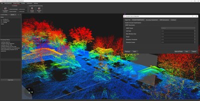
PCMasterPro 1.16 facilitates autonomous data processing and management using an updated batch processor equipped with profiles, templates and intuitive workflows. New command-line utilities and a user-friendly interface enable 3D professionals to customize their workflows with desired inputs. Extensive optimization features including mass implementation of parallel processes and real-time quality control haptics further simplify data import, projection and export, significantly improving data processing capabilities and user experience.

"Having trusted data and end-to-end 3D processing and refinement across hardware and software is essential to ensuring accuracy, consistency and reliability from capture to visualization," said Jamie Marraccini, Vice President, Inertial Labs Products, VIAVI. "PCMasterPro, which supports the RESEPI product line, offers these capabilities – from tightly coupled inertial-based algorithms and reporting to locally referenced simultaneous localization and mapping (SLAM) generated point clouds. These tools enable professionals to make confident decisions, scale complex workflows and create digital twins that realistically reflect the real world."

To further support digital twin users, PCMasterPro 1.16 has expanded its export format types to include PCD, PLY, E57, LAS and LAZ in colorized and uncolorized workflows. The models have photorealistic capabilities by embedding RGB information in data points.

Other updates to the software include support for additional coordinate systems, accuracy reporting, colorization options within the interface, real-time streaming updates, enhanced support for ground control points and more. In addition, a calibration toolchain improves camera alignment and projection quality, ensuring the user is getting the best results.

About VIAVI
VIAVI (NASDAQ: VIAV) is a global leader in test and measurement and optical technologies. Our test, monitoring, assurance, and resilient position, navigation and timing solutions enable and secure critical infrastructure ranging from data center ecosystems and communication networks to military, aerospace, railway and first responder communications. In addition, we develop and advance technologies used in high-volume optical applications across anti-counterfeiting, consumer electronics, aerospace, industrial and automotive end markets.

Learn more about VIAVI at www.viavisolutions.com. Follow us on VIAVI Perspectives, LinkedIn and YouTube.

Media Inquiries:
Grand Bridges
Emma Jenkins
emma@grandbridges.com
+1 415 800 4529
 

Cision View original content to download multimedia:https://www.prnewswire.com/news-releases/inertial-labs-a-viavi-solutions-company-advances-3d-terrain-and-surface-modeling-with-pcmasterpro-1-16-for-resepi-302741465.html

SOURCE VIAVI Solutions

FAQ

What performance improvement does PCMasterPro 1.16 provide for VIAV RESEPI users?

PCMasterPro 1.16 delivers up to 200% faster processing for 3D workflows. According to the company, the update uses parallel processes and optimized batch processing to accelerate point-cloud import, projection and export for RESEPI-derived datasets.

Which export formats does PCMasterPro 1.16 support for VIAV (VIAV) RESEPI projects?

PCMasterPro 1.16 supports PCD, PLY, E57, LAS and LAZ export formats. According to the company, colorized and uncolorized workflows are available and RGB embedding enables photorealistic point-cloud models.

How does PCMasterPro 1.16 help with data processing automation for RESEPI (VIAV) users?

The release adds an updated batch processor, profiles, templates and command-line utilities for automation. According to the company, these features enable scalable, unattended processing and customizable workflows for large RESEPI datasets.

What quality-control and calibration features are included in PCMasterPro 1.16 for VIAV RESEPI?

PCMasterPro 1.16 includes real-time quality-control haptics and an improved camera calibration toolchain. According to the company, these features enhance camera alignment, projection quality and confidence in generated point-clouds.

Who are the primary users of PCMasterPro 1.16 for RESEPI within VIAV's target markets?

Primary users include engineers, cartographers, surveyors and VFX designers focused on digital twins. According to the company, the software supports RESEPI sensor fusion and workflows for realistic geospatial and 3D model generation.
